Vr Mapping |
ON-LINE REFERENCE DOCUMENTATION CARDINAL SYSTEMS, LLC |
XML In (XmlIn)
Type: Translator
Translates LandXML schema based surface XML files into Vr Mapping's VrOne data files

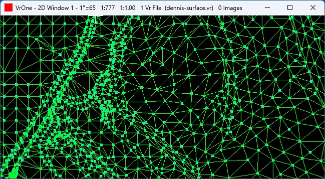
The XML In translator converts surface data, which typically includes features such as break and boundary lines, points, and triangle lines (faces) in from a XML file or files to the Vr Mapping's VrOne file or files. This translator uses the LandXML's schema but does not support all the elements that are available in that schema.

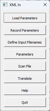
Loads previously recorded XML In (.xmi) parameter file.
Records current translation parameters to a XML In (.xmi) parameter file.
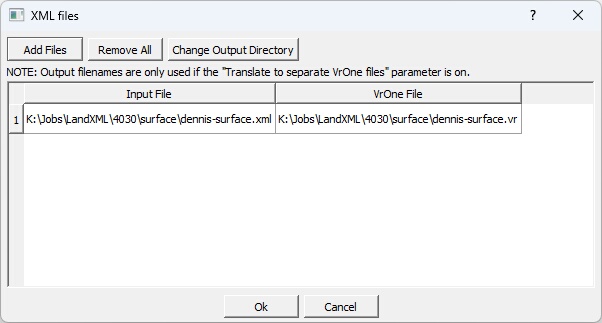
Allows XML input files to be selected. Also allows a VrOne output file to be defined for each input file. Looks for files with an extension of .xml by default, but attempts to read in any file chosen.
The VrOne output filenames are only used if the "Translate to separate VrOne files" option is on.

The Define Input Filenames dialog box
| • | Add Files - Displays a standard VrOne file selection dialog. All files selected are added to the list of Input files. Generates a VrOne output filename based on each input filename. |
| • | Remove All - Removes all files from the Input file table. |
| • | Change Output Directory - Allows changing the output directory (folder). By default, the output directory is the same as the input file directory. |
Allows the entry and editing of translation parameters.

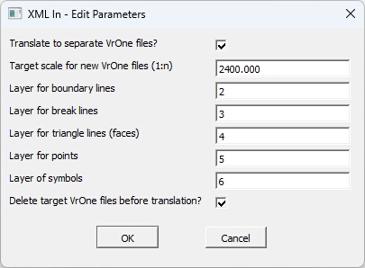
The Edit Parameters dialog Box
Translate to separate VrOne files?
Determines whether the XML input files are translated to a separate VrOne files. The Input to Output filename cross-reference is set in the "Define Input Filenames" dialog.
Target Scale for new VrOne files (1:n)
Defines target scale to use when creating the new VrOne file if the "Translate to separate VrOne files?" is on and a VrOne file does not exist during translation.
Layer for boundary lines
Specifies layer into which to place boundary lines. The boundary lines are defined with the Boundary element in the XML file(s). If this field is set to zero then boundary lines will not be translated.
Layer for break lines
Specifies layer into which to place break lines. The break lines are defined with the Breakline element in the XML file(s). If this field is set to zero then break lines will not be translated.
Layer for triangle lines (faces)
Specifies layer into which to place break lines. The triangle lines are defined with the Faces element that is preceded with the Pnts element in the XML file(s). If this field is set to zero then triangle lines (faces) will not be translated.
Layer for points
Specifies layer into which to place translated points. If this layer is specified, the coordinate positions in the Pnts element will be saved as VrPoints, which is the data type typically used to store LiDAR and/or point cloud data. If this field is set to zero then points will not be translated as VrPoints.
Layer for symbols
Specifies layer into which to place translated symbols. If this layer is specified, the coordinate positions in the CgPoints element will be saved as symbols. NOTE: If this field is set to zero then points will not be translated as VrPoints.
Delete target VrOne files before translation?
If this option is checked each target VrOne file will be deleted before translation if it exists. If this option is unchecked and the target VrOne file exists, the new data will be appended to the file. This parameter is considered only if the "Translate to separate VrOne files" option is checked.
Begins the file translation process. All files that were defined by the “Define input Filenames” option are imported.
Starts the browser and displays the current help document.
Quits XML In and allows current parameters to be saved if they were altered.
XML In (GriIn)
- Added December 2023 - Version 07.01.22