Vr Mapping |
ON-LINE REFERENCE DOCUMENTATION CARDINAL SYSTEMS, LLC |
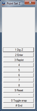
Point Set Z (PoiSetZ)
Type: Interactive - Display Management
When the Point Z Slice filter is active only points that fall within the elevation range are displayed. This filter is useful when some of the point data -- like decks, tunnels, and areas of tree cover -- obscure other data. The Z Slice filter may be turned on/off with the check box. The following is an example of a Z Slice applied to an overpass area in which LiDAR data was collected on a highway overpass and on the roadway under it. By using the Z Slice filter, either the overpass or the roadway may be isolated for viewing and data collection.
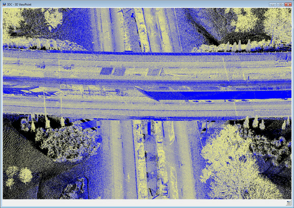
Overpass area with all data displayed
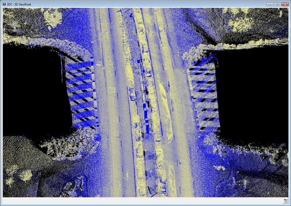
Overpass area with Z Slice showing roadway without bridge deck
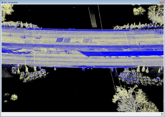
Overpass area with Z Slice showing bridge deck without road
The Z Slice is defined as a base elevation (Base Z) and an elevation range (Range Z). The Z Slice is computed by subtracting the Range Z from the Base Z for the lower elevation and by adding the Range Z to the Base Z for the upper elevation.
Points with an elevation in the Z Slice range will be displayed if the point passes other active point filters also.
The Z Slice parameters may also be set in Point Display (PoiDis).
Local Commands
Key-in |
Description |
Range |
BasZ= |
Sets the Base Z |
Ground coordinate |
RanZ= |
Sets the Range Z |
Ground coordinate |
Button Assignments
Point Set Z
Button |
Description |
1 Dig Z |
Digitizes an elevation at the current cursor location for the Base Z |
2 Enter |
Allows entry/edit of the Base Z and the Range Z |
3 Replot |
Replots graphics |
4 |
|
5 |
|
6 |
|
7 |
|
8 |
|
9 Reset |
Resets parameters |
* |
|
0 Toggle snap |
Toggles snapping on / off |
# End |
Ends Point Set Z |